Geolocated Analysis of the ISRAEL – HAMAS Conflict
Executive Summary :-
On 7th October 2023 sirens echoed just before the Dawn , Hamas Launches a full-fledged attack on ISRAEL , It was the day of “SUKKOT” an Auspicious Day according to ISRAELIS . Around 5000 missiles were fired from GAZA that the “IRON DOME” System which is basically an Air-Defense system of ISRAEL didn’t even got the chance to show it’s full resistance from the Missiles . Soon Many HAMAS Terrorists invaded many cities of Southern ISRAEL through Paragliders , Boats . They Broke the Armistice Agreement Line with Bulldozers and rushed into the Cities from Bikes .
In this Brief Report I have Geolocated the Areas of Invasion including the Areas where the Artillery Firings and Military Movements are going on with great Force .
Data Collection and Verification :-
I have collected a diverse range of Open-Source Media Materials from Reputable Sources Such as News Agencies , Verified Social Media Accounts , Leaked CCTV Footages . : Each attack site was meticulously marked on Google Earth, with specific latitude and longitude coordinates.
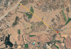
Trance Music Festival Site probably 10kms from the Border
In the Early Hours of Saturday Morning , On the Outskirts of Kibbutz Reim many people were gathered for a Trance Music Festival , Soon the festival of Music and Joy turned into a Bloody and Horrific Massacre . Hamas Militants started Firing and Captured many Innocent lives as Hostages and took them to GAZA . Around 260 bodies were found from the concert site on Sunday according to ZAKA, a volunteer emergency response group in Israel.
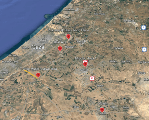
The locations of Hamas Attack
On 10th October 2023 During my Research , I have found a Live Footage of the Military movements and Police Barricades on a Regional Road of ISRAEL . As per predictions Civilians were being evacuated from the Place as the Satellite image shows many Civilian houses were there .
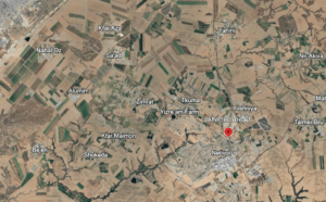
Regional Road No.25
The place is very near the border area, and the footage shows that Israeli tanks and artillery were being sent towards Kfar Aza.
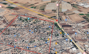
The Yellow Line represents the Direction where Tanks were being sent and the Red Line Area focuses on the Civilian houses .
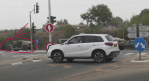
Footage of a Military Vehicle on the Regional Roads
I have used the NASA’s open-source fire mapping service, FIRMs (Fire Information for Resource Management System), and got the Historical Thermal Data of 7th October to map the conflicted zones .
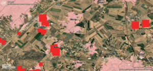
The Red marks representing the Conflict zones based on Thermal Data .
On 11th October, James Cleverly ,Foreign Secretary, travelled with Foreign Minister Eli Cohen to the southern Israeli village of Ofakim to witness first-hand the devastation caused by Hamas. On the first visit by a foreign minister to a site of the attacks, Cleverly met survivors to emphasize that the UK stands with them against terrorism.
In a video, it can be shown that James Cleverly, the foreign secretary, had to flee to safety in Israel as air raid sirens warned of an approaching rocket strike.
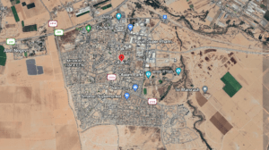
Through meticulous geolocation, I have accurately pinpointed and marked numerous attack sites, shedding light on the extent and impact of hostilities in the region. This detailed mapping has been critical for understanding the conflict’s immediate consequences.
Rahul Chakraborty
